


VTD-precinct 12 EAberdeen, Brown County, South Dakota
About
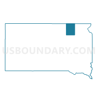
Outline

Summary
| Unique Area Identifier | 667033 |
| Name | VTD-precinct 12 EAberdeen |
| County | Brown County |
| State | South Dakota |
| Area (square miles) | 52.53 |
| Land Area (square miles) | 52.53 |
| Water Area (square miles) | 0.01 |
| % of Land Area | 99.99 |
| % of Water Area | 0.01 |
| Latitude of the Internal Point | 45.45258160 |
| Longtitude of the Internal Point | -98.36355970 |
Maps


Graphs
Select a template below for downloading or customizing gragh for VTD-precinct 12 EAberdeen, Brown County, South Dakota


Neighbors
Neighoring Voting District (by Name) Neighboring Voting District on the Map
- VTD-precinct 10 Aberdeen, Brown County, SD
- VTD-precinct 11 Aberdeen, Brown County, SD
- VTD-precinct 13 Shlby--Clmbia-Cmbria-OrdwyTwp-ClmbiaCity, Brown County, SD
- VTD-precinct 15 Franklin-Carlisle-Ravinia-Mercier-LincolnTwp, Brown County, SD
- VTD-precinct 16 WAberdeenTwp, Brown County, SD
- VTD-precinct 17 Highland-NewHope-WarnerTwp-Warner, Brown County, SD
- VTD-precinct 18 Gem-WRondell-ERondellTwp-Stratford, Brown County, SD
- VTD-precinct 19, Brown County, SD
- VTD-precinct 2 Aberdeen, Brown County, SD
- VTD-precinct 6 Aberdeen, Brown County, SD
- VTD-precinct 7 Aberdeen, Brown County, SD
Top 10 Neighboring County Subdivision (by Population) Neighboring County Subdivision on the Map
- Aberdeen city, Brown County, SD (26,091)
- Lincoln township, Brown County, SD (1,274)
- Aberdeen township, Brown County, SD (934)
- Bath township, Brown County, SD (735)
- Warner township, Brown County, SD (580)
- Ordway township, Brown County, SD (300)
- Prairiewood township, Brown County, SD (266)
- Gem township, Brown County, SD (217)
- Henry township, Brown County, SD (129)
- Cambria township, Brown County, SD (125)
Top 10 Neighboring Place (by Population) Neighboring Place on the Map
Top 10 Neighboring Unified School District (by Population) Neighboring Unified School District on the Map
Top 10 Neighboring State Legislative District Lower Chamber (by Population) Neighboring State Legislative District Lower Chamber on the Map
Top 10 Neighboring State Legislative District Upper Chamber (by Population) Neighboring State Legislative District Upper Chamber on the Map
Top 10 Neighboring 111th Congressional District (by Population) Neighboring 111th Congressional District on the Map
Top 10 Neighboring Census Tract (by Population) Neighboring Census Tract on the Map
- Census Tract 9514, Brown County, SD (6,228)
- Census Tract 9518, Brown County, SD (4,964)
- Census Tract 9520, Brown County, SD (4,412)
- Census Tract 9517, Brown County, SD (4,274)
- Census Tract 9519, Brown County, SD (3,530)